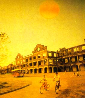
Corregidor Island

Corregidor is known the world over for its role in war, bravery, and history. It is three miles long and 1 ½ miles at its widest point, facing the China Sea and flanked by the provinces of Bataan and Cavite. A rock island remarkably shaped like a tadpole at the entrance of Manila Bay, Corregidor's strategic location was vital in the defense of Manila during World War II.
The name 'Corregidor' came from the Spanish 'corregir', or 'to correct', since the island was a checkpoint for vessels entering Manila Bay during the Spanish and American occupations. Perhaps it is Corregidor's geographical proximity to Bataan and existing inaccurate historical writings that cause many to associate the rock island with the Death March, which came shortly after the Fall of Bataan.
Corregidor became the headquarters of the Allied Forces and also the seat of the Philippine Commonwealth government. It was from Corregidor that Philippine Pres. Manuel Quezon and MacArthur left for Australia in February leaving behind Lt. Gen. Jonathan M. Wainwright in command.
Today, Corregidor's rich history continues to draw Filipinos and foreign tourists alike, making the island one of the most visited tourist spots in the country. For first-time Filipino visitors, Corregidor reacquaints them with the past and helps them discover their national identity. The island is home to many historical treasures.


0 Comments:
Post a Comment
Subscribe to Post Comments [Atom]
<< Home